Australia Weather News
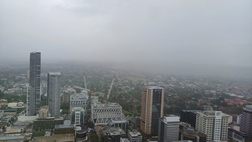
Australia's east coast is set for more wet, humid days due to an intrusion of tropical moisture. (ABC News: Tom Saunders)
A mass of tropical air engulfing eastern Australia is leading to both uncomfortable humidity and another round of flooding rains.
The moist winds closely resemble a monsoon flow even south of the tropics and have combined with a low-pressure system to generate a 2,000-kilometre-long rainband.
In parts of western Queensland, rain totals from the system have already reached five times the March average, while ongoing deluges in Townsville have lifted its 2025 year-to-date rainfall above 2,000 millimetres — already the city's wettest year in a quarter of a century.
During the next 48 hours, hundreds of millimetres will continue to fill outback rivers, however, the rainband should track east from Friday, raising the possibility of flooding across south-east Queensland and parts of NSW this weekend.
Unbearable humidity triggers torrential rain
Exceptionally high summer humidity across eastern Australia has lingered into March and mugginess this week is reaching uncomfortable levels as moist winds arrive from the warm waters off the northern coastline.
However, moisture only transitions into cloud and rain when it is lifted vertically — a process occurring forcefully this week due to the presence of the low over the interior.
The system has already brought four consecutive days of heavy rain near the Northern Territory/Queensland border, triggering more than 20 flood watches and warnings.
The heaviest rain today will continue flooding rivers across Queensland's outback, with 24-hour totals in excess of 100 millimetres possible from about Longreach down to near the NSW border, although moderate falls are also soaking parts of the coast.
The intense rain rates are not only leading to widespread river flooding but also dangerous flash flooding, with the Bureau of Meteorology warning of six-hourly totals up to 80mm.
Rivers will continue to rise rapidly through Thursday and Friday as the near-stationary low maintains torrential rain across the inland, including the possibility of further 24-hour totals near 100mm.
Brisbane, Sydney rain to increase
After spending the entire week tracking only slowly across the outback, the inland low will accelerate towards the coast by the weekend.
Brisbane is already predicted to receive light to moderate rain through today and Thursday, before the advancing low brings heavier falls on Friday and Saturday that could accumulate to more than 100mm.
After ex-Tropical Cyclone Alfred a few weeks ago, Brisbane has been drenched by more than 500mm this month, already the wettest March in more than 130 years.
At times this week, modelling has predicted up to 200mm in parts of south-east Queensland this week, enough for areas of flooding, but thankfully the favoured range is now around 50 to 100mm.
For NSW, the increasingly mobile low will also lead to an increase in rain, including totals up to 100mm in the state's north.
How far south the tropical rain reaches is still uncertain, meaning Sydney could receive anything from 20 to 50mm during the coming days.
The band of rain should then clear off the east coast on Sunday, although medium-range modelling into April is indicating further widespread rain events
Weather resembles monsoon well outside of tropics
For north-west Australia, a monsoon is active this week, which signifies the air flowing overhead is cross-equatorial — meaning it has passed over the equator before reaching Australia.
While the airstream reaching central and southern Queensland is not technically a monsoon, the pattern is a near-replica, with very moist air arriving from both the north-east and north-west.
The monsoon resemblance for Queensland is close to the perfect rain machine, as the near-stationary inland low-pressure system is fed a constant supply of moisture.
Pulses of tropical humidity reaching inland areas of northern Australia are common in the wet season, however, this week's intrusion is more extensive than normal, spreading right down to northern NSW.
Even the Channel Country — the driest part of Queensland — has picked up hundreds of millimetres since the weekend — that's more than six months' worth of rain for the region.
For example, Bedourie, right near the South Australia border, had collected 150mm by 9am Tuesday, already the town's wettest calendar month since March 2011.
The floodwaters growing across south-west Queensland will spend the next few months draining slowly south to Lake Eyre, which should result in at least a partial filling of the normally dry lake by the middle of winter.
ABC